

SAM
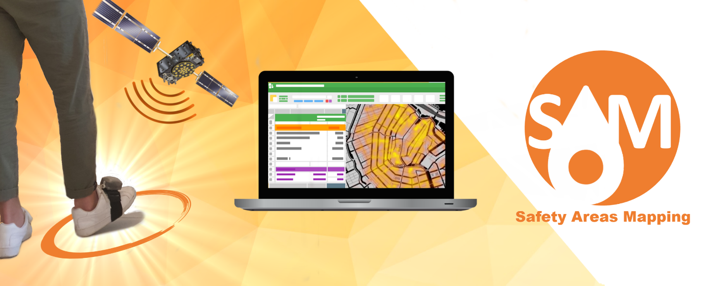
SAM (Safety Areas Mapping) is a self-contained safety area mapping solution that eases the observation of the spread of risks thanks to highly accurate maps generated by a pedestrian. It leverages inertial and dual-frequency Galileo signals to rapidly and automatically produce risk areas maps, both indoors and outdoors, without any prior installation. It supports natural or industrial crisis management.
Health: a major issue... addressed by a legal context
According to the World Health Organization (WHO), many chemicals can have negative health effects. For example, 9% of the global burden of lung cancer is attributed to occupational exposure to toxic substances and 5% to outdoor air pollution. To anticipate these risks, many tools and procedures are set up to predict and assess hazards at different scales. In 2018, the Council of the European Union adopted the new directive on the European Electronic Communications Code, implying that all EU member states will have to set up a public alert system to protect citizens with cell-phone alerts for situations of a natural disaster, terrorist attack or any other major emergency in their region. Mandatory implementation of the public alert system will have to be in place by June 21, 2022.
Risk mapping provides a basis for risk management, but it is as important to be able to react quickly when a serious and unusual incident such as an explosion or fire occurs. In this type of situation, the priority is to define and quantify the threat while assigning it to a geographical zone. This step must be carried out quickly to react and set up protocols as soon as possible.


SAM : a self-contained safety area mapping solution
SAM targets situations requiring a quick and precise mapping of a chemical or polluting hazard. In the context of an explosion in a sensitive environment, such as the Lubrizol case, our solution will enable us to quickly equip protected employees to carry out the measurement campaigns of the various risks related to the explosion, both in the building and in the surrounding streets. These data, precisely synchronized, are then analyzed in post-processing to create accurate and uniform maps of the various risks and set up zones to protect employees and adapt protocols.
The proposed SAM solution is set up to meet the following constraints:
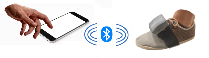
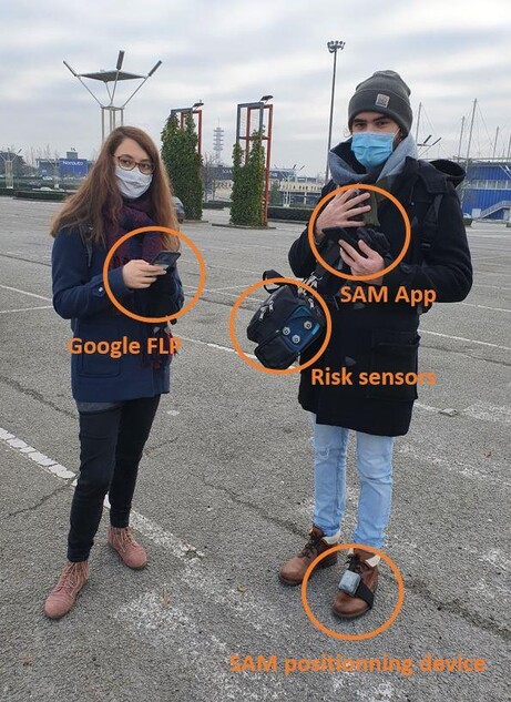
An easy to use tool accessible to everyone. For this, a simple foot-mounted device with a quick and intuitive attachment system was created. Once the tool is started, it estimates the trajectory followed by a person during the surveying campaign in post-processing mode. This ease of use supports the goal of large adoption. The foot-mounted device can be controlled by a user interface implemented on a smartphone, tablet or smartwatch.
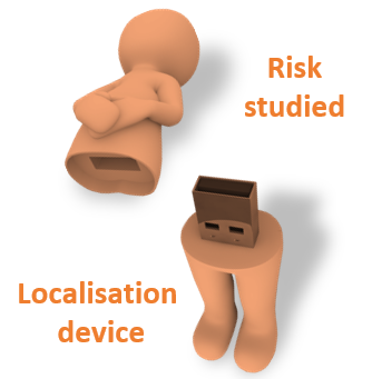
A unique tool adapted to all situations and all measuring devices. SAM mapping device works independently of the risk measuring device and does not require the use of hands. it is designed as a localization peripheral able to fit the majority of human risk measurement campaigns. The data collected by the risk sensor is precisely linked to the trajectory thanks to a dedicated synchronization process of the different sensors.
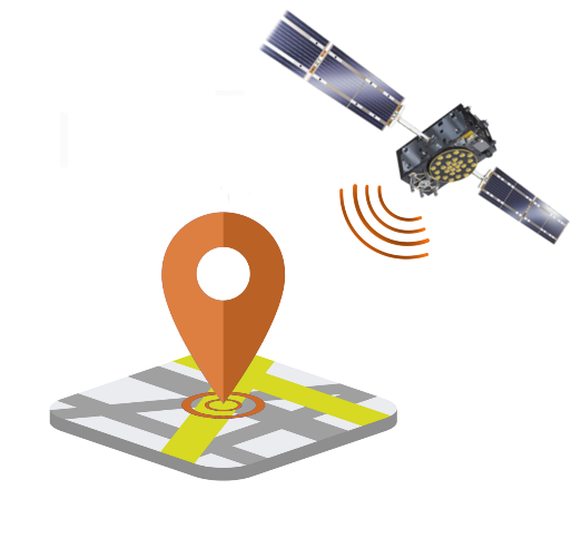
An accurate positioning tool providing a mapping solution despite the user's movement and regardless of the working environment. The proposed solution uses Galileo signals (E1B/C and E5b signals) tighly coupled with inertial signals for challenging indoor and urban spaces in a fully self contained approach offering a submeter level mapping solution indoors and outdoors, without any transition problems. in addition to leaving free the use of hands, placing the sensor on the foot allows to use walking biomechanics for the estimation of the position.
A privacy by design tool allowing the user to control his data thanks to a solution not based on wireless signal transmission.
SAM Experimentation
REAL LIFE CONDITION TESTS
SAM Experiments conducted in real life conditions: the largest shopping mall in Nantes, France, Atlantis shopping mall (https://www.atlantis-nantes.com).
A path of about 3 kilometers was carried out by walking in order to cover the entire shopping gallery and the main parking lot. The path is approximatively 60% outdoor and 40% indoor.
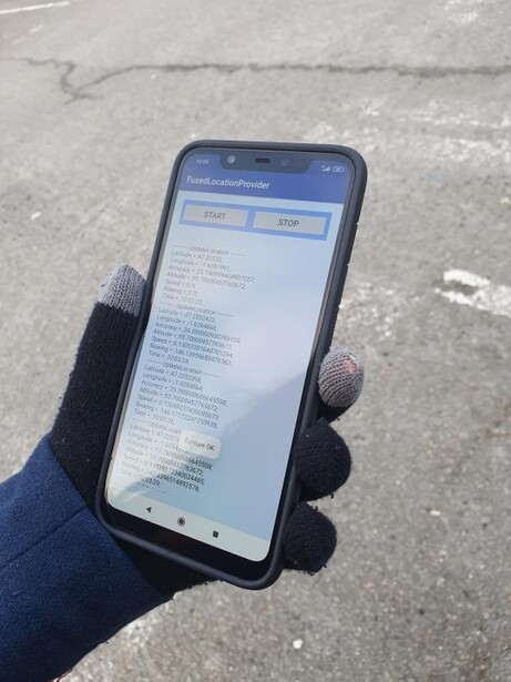
For this experiment, Mercury and nanoparticles sensors are carried in a bag, and the positioning device is foot-mounted. To observe the benefits of SAM solution concerning the positioning accuracy, we use another smartphone to record the followed track with the Google Fused Location Provider solution. This Google tool is the most used application for smartphone positioning and the one used by Google maps for example. It use GNSS, inertial but also Wi-Fi and cellular data.
ASSESSMENT OF THE INDOOR/OUTDOOR POSITIONING ACCURACY
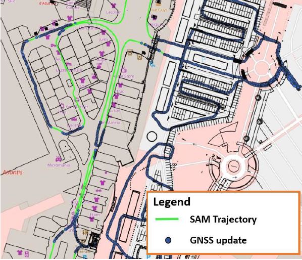
A visualization of GNSS used measurement instants on the trajectory
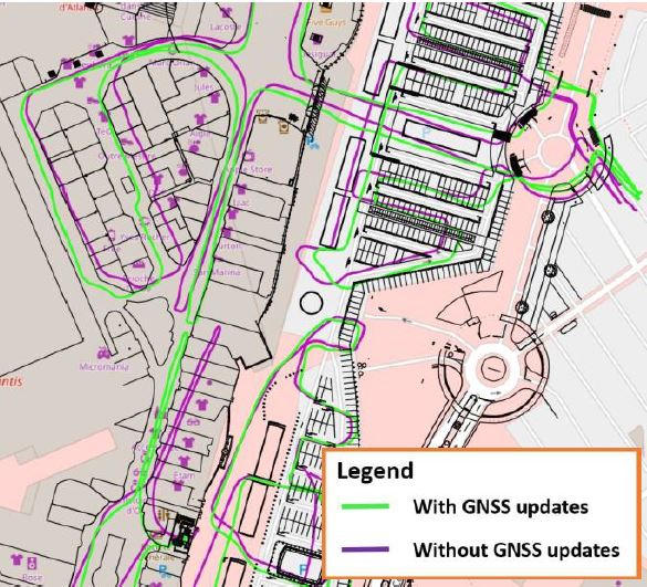
A comparison with the trajectory obtain without GNSS data
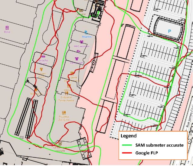
Comparison with the Google Fused locator Provider trajectory illustrating multipath effect on Google solution and submeter accuracy of SAM trajectory
MyGalileoSolution
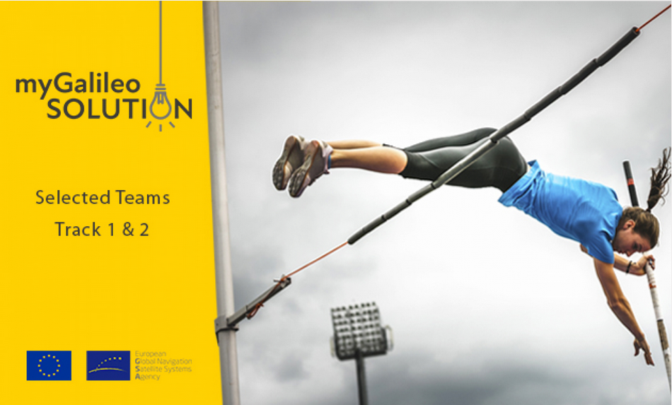
SAM: Safety Areas Mapping is one of the 30 finalists of track 1 of MyGalileoSolution 2020.
MyGalileoSolution
The aim of the contest is to develop a location-based solution, such as mobile application, wearable-based solution, asset management, tracking solution, or robotics, leveraging Galileo as a source of positioning, navigation and/or timing.
THE CHALLENGE
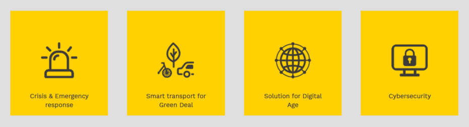
Each participating team shall propose a solution targeting one of the following innovation areas:
SAM's area of innovation is Crisis & Emergency response.
For more informations about MyGalileoSolution, see the website: https://www.gsa.europa.eu/mygalileosolution
